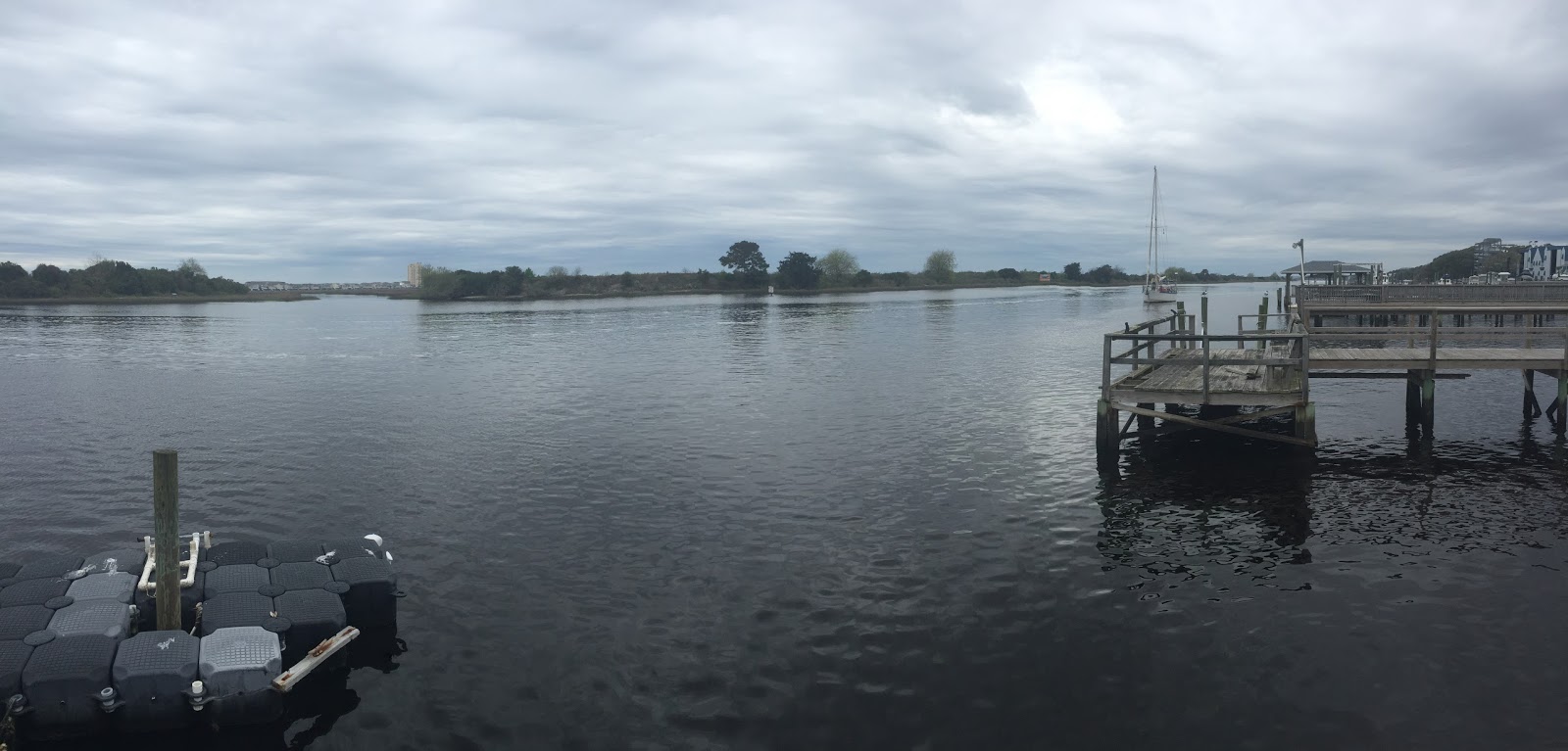


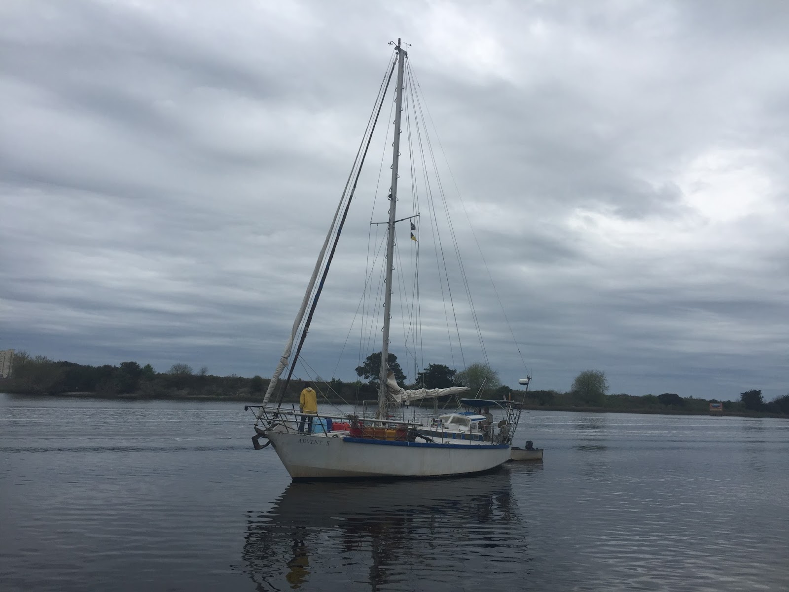
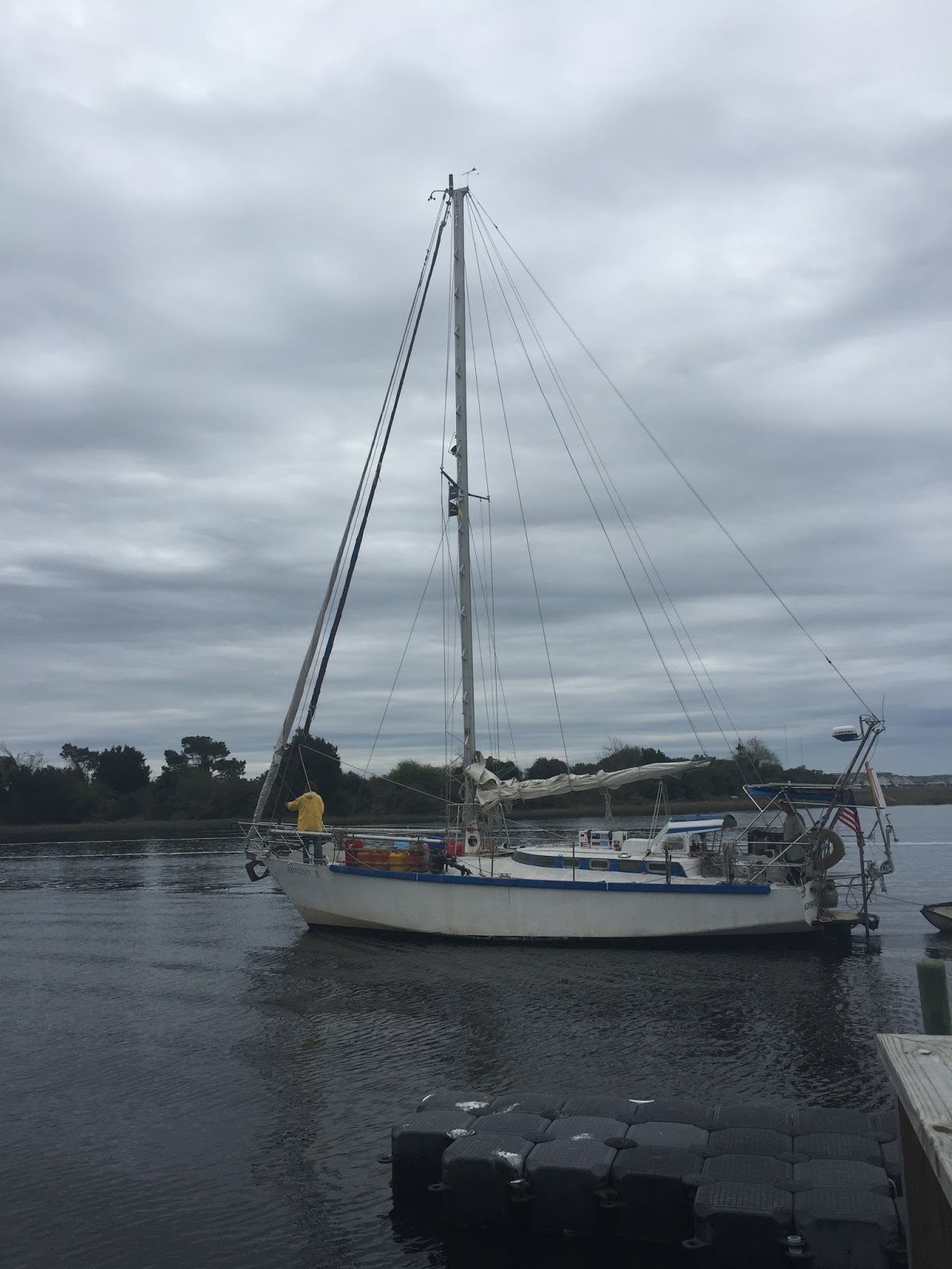
Anchor down calabash crk north carolina. Home
View the location or send a reply to William Doar: https://explore.delorme.com/textmessage/txtmsg?extId=eea2ae86-feea-4a3a-ba25-19de546cee22&adr=billdoar2.advent2%40blogger.com
William Doar sent this message from: Lat 33.874079 Lon -78.570035
Do not reply directly to this message.
This message was sent to you using the DeLorme inReach two-way satellite communicator with GPS. To learn more, visit http://www.delorme.com/inReach/
Ican see buildings on myrtle beach
View the location or send a reply to William Doar: https://explore.delorme.com/textmessage/txtmsg?extId=4da3d0b3-162a-49e7-846c-a958c22fee48&adr=billdoar2.advent2%40blogger.com
William Doar sent this message from: Lat 33.423918 Lon -78.763475
Do not reply directly to this message.
This message was sent to you using the DeLorme inReach two-way satellite communicator with GPS. To learn more, visit http://www.delorme.com/inReach/
1200 28nm to little river . Eta 1830
View the location or send a reply to William Doar: https://explore.delorme.com/textmessage/txtmsg?extId=aa1fed8f-7c7a-4a4b-b90e-f11b141b3a36&adr=billdoar2.advent2%40blogger.com
William Doar sent this message from: Lat 33.419305 Lon -78.765793
Do not reply directly to this message.
This message was sent to you using the DeLorme inReach two-way satellite communicator with GPS. To learn more, visit http://www.delorme.com/inReach/
To doarway friday
View the location or send a reply to William Doar: https://explore.delorme.com/textmessage/txtmsg?extId=48f48d01-9afb-4dac-8082-85bc03fc06ec&adr=billdoar2.advent2%40blogger.com
William Doar sent this message from: Lat 31.969979 Lon -80.073702
Do not reply directly to this message.
This message was sent to you using the DeLorme inReach two-way satellite communicator with GPS. To learn more, visit http://www.delorme.com/inReach/
Anchor little river for the night
View the location or send a reply to William Doar: https://explore.delorme.com/textmessage/txtmsg?extId=dd1a8e16-b5ff-4ac7-8f71-22a29adcbef7&adr=billdoar2.advent2%40blogger.com
William Doar sent this message from: Lat 31.967533 Lon -80.076878
Do not reply directly to this message.
This message was sent to you using the DeLorme inReach two-way satellite communicator with GPS. To learn more, visit http://www.delorme.com/inReach/
Then north to little river
View the location or send a reply to William Doar: https://explore.delorme.com/textmessage/txtmsg?extId=df3ca22e-cc9a-4f06-b30a-392b062ae1ff&adr=billdoar2.advent2%40blogger.com
William Doar sent this message from: Lat 31.963477 Lon -80.082049
Do not reply directly to this message.
This message was sent to you using the DeLorme inReach two-way satellite communicator with GPS. To learn more, visit http://www.delorme.com/inReach/
Willstay 30nm off charleston and cape romain
View the location or send a reply to William Doar: https://explore.delorme.com/textmessage/txtmsg?extId=7913f94e-1a96-4411-801a-7ccce493d8c7&adr=billdoar2.advent2%40blogger.com
William Doar sent this message from: Lat 31.960709 Lon -80.085804
Do not reply directly to this message.
This message was sent to you using the DeLorme inReach two-way satellite communicator with GPS. To learn more, visit http://www.delorme.com/inReach/
At noon 30 nm south east port royal. light wind easy sea
View the location or send a reply to William Doar: https://explore.delorme.com/textmessage/txtmsg?extId=9bd23c01-ba29-4adf-9d5b-b73ac8aab2ac&adr=billdoar2.advent2%40blogger.com
William Doar sent this message from: Lat 31.937556 Lon -80.11694
Do not reply directly to this message.
This message was sent to you using the DeLorme inReach two-way satellite communicator with GPS. To learn more, visit http://www.delorme.com/inReach/
Plan C050 to wpt 33-00, 078-30,
View the location or send a reply to William Doar: https://explore.delorme.com/textmessage/txtmsg?extId=f97077b0-c693-44cc-b0c5-53567a20d555&adr=billdoar2.advent2%40blogger.com
William Doar sent this message from: Lat 31.955291 Lon -80.093122
Do not reply directly to this message.
This message was sent to you using the DeLorme inReach two-way satellite communicator with GPS. To learn more, visit http://www.delorme.com/inReach/
I'm starting from here.
View the location or send a reply to William Doar: https://explore.delorme.com/textmessage/txtmsg?extId=ca87d59a-739b-4161-850a-e55c6734934d&adr=billdoar2.advent2%40blogger.com
William Doar sent this message from: Lat 30.676382 Lon -81.465704
Do not reply directly to this message.
This message was sent to you using the DeLorme inReach two-way satellite communicator with GPS. To learn more, visit http://www.delorme.com/inReach/
William Doar is sharing their location at the MapShare web site: https://share.delorme.com/Advent2
Password:
I'm starting my trip, follow along at my MapShare!
Do not reply directly to this message.
To learn more about MapShare and the DeLorme inReach two-way satellite communicator, visit http://delorme.com/inReach or http://inReachCanada.com
Anchor down USA
View the location or send a reply to William Doar: https://explore.delorme.com/textmessage/txtmsg?extId=51ba01c9-7b34-4567-b8c0-92029e44f8ff&adr=billdoar2.advent2%40blogger.com
William Doar sent this message from: Lat 30.673699 Lon -81.471133
Do not reply directly to this message.
This message was sent to you using the DeLorme inReach two-way satellite communicator with GPS. To learn more, visit http://www.delorme.com/inReach/
Going to fernandina
View the location or send a reply to William Doar: https://explore.delorme.com/textmessage/txtmsg?extId=aeae788b-687d-401e-958a-c41e67c470d3&adr=billdoar2.advent2%40blogger.com
William Doar sent this message from: Lat 30.063239 Lon -80.699108
Do not reply directly to this message.
This message was sent to you using the DeLorme inReach two-way satellite communicator with GPS. To learn more, visit http://www.delorme.com/inReach/
Am going to pass canaveral . Try for st augustine . Gulf stream very bumpy.
View the location or send a reply to William Doar: https://explore.delorme.com/textmessage/txtmsg?extId=8bb6db41-f8ea-49dd-835f-ed71e9c5b170&adr=billdoar2.advent2%40blogger.com
William Doar sent this message from: Lat 28.324428 Lon -80.046322
Do not reply directly to this message.
This message was sent to you using the DeLorme inReach two-way satellite communicator with GPS. To learn more, visit http://www.delorme.com/inReach/
Off the banks and back in the ocean . cape canaveral 95Miles
View the location or send a reply to William Doar: https://explore.delorme.com/textmessage/txtmsg?extId=6a8dbfc7-7d4a-4f6c-b440-5f6fe6829ff1&adr=billdoar2.advent2%40blogger.com
William Doar sent this message from: Lat 27.354519 Lon -79.213872
Do not reply directly to this message.
This message was sent to you using the DeLorme inReach two-way satellite communicator with GPS. To learn more, visit http://www.delorme.com/inReach/
3 knots
View the location or send a reply to William Doar: https://explore.delorme.com/textmessage/txtmsg?extId=2927ae32-8cbb-462c-8535-658d5f207a76&adr=billdoar2.advent2%40blogger.com
William Doar sent this message from: Lat 27.220044 Lon -78.894882
Do not reply directly to this message.
This message was sent to you using the DeLorme inReach two-way satellite communicator with GPS. To learn more, visit http://www.delorme.com/inReach/
Oops . 4Kts and dropping
View the location or send a reply to William Doar: https://explore.delorme.com/textmessage/txtmsg?extId=69776130-b25b-4e55-a1ba-5e32236f6b3f&adr=billdoar2.advent2%40blogger.com
William Doar sent this message from: Lat 27.208704 Lon -78.867309
Do not reply directly to this message.
This message was sent to you using the DeLorme inReach two-way satellite communicator with GPS. To learn more, visit http://www.delorme.com/inReach/
Light wind. Main genoa and drifter. 5Kts
View the location or send a reply to William Doar: https://explore.delorme.com/textmessage/txtmsg?extId=65066857-a408-4b5c-bd2d-7401e2baa220&adr=billdoar2.advent2%40blogger.com
William Doar sent this message from: Lat 27.207438 Lon -78.863983
Do not reply directly to this message.
This message was sent to you using the DeLorme inReach two-way satellite communicator with GPS. To learn more, visit http://www.delorme.com/inReach/
I can see the loom of fla lights 90 miles away. start sailing now.
View the location or send a reply to William Doar: https://explore.delorme.com/textmessage/txtmsg?extId=14f23714-61b1-471b-b4c4-0f1f78817f38&adr=billdoar2.advent2%40blogger.com
William Doar sent this message from: Lat 26.977776 Lon -78.239994
Do not reply directly to this message.
This message was sent to you using the DeLorme inReach two-way satellite communicator with GPS. To learn more, visit http://www.delorme.com/inReach/
William Doar is sharing their location at the MapShare web site: https://share.delorme.com/Advent2
Password:
I'm starting my trip, follow along at my MapShare!
Do not reply directly to this message.
To learn more about MapShare and the DeLorme inReach two-way satellite communicator, visit http://delorme.com/inReach or http://inReachCanada.com
Great sale cay. Good anchorage. nothing here. no people
View the location or send a reply to William Doar: https://explore.delorme.com/textmessage/txtmsg?extId=afddbb89-6641-438b-ae46-6cb6a844f881&adr=billdoar2.advent2%40blogger.com
William Doar sent this message from: Lat 26.979793 Lon -78.216712
Do not reply directly to this message.
This message was sent to you using the DeLorme inReach two-way satellite communicator with GPS. To learn more, visit http://www.delorme.com/inReach/
Av great sale cay just as it was getting dark
View the location or send a reply to William Doar: https://explore.delorme.com/textmessage/txtmsg?extId=acc0d4d3-e9a2-44e5-8c79-36d4aafbb70f&adr=billdoar2.advent2%40blogger.com
William Doar sent this message from: Lat 26.979686 Lon -78.21667
Do not reply directly to this message.
This message was sent to you using the DeLorme inReach two-way satellite communicator with GPS. To learn more, visit http://www.delorme.com/inReach/
I'm stopping here.
View the location or send a reply to William Doar: https://explore.delorme.com/textmessage/txtmsg?extId=83213c34-3741-4951-bd37-4ddc91a0117d&adr=billdoar2.advent2%40blogger.com
William Doar sent this message from: Lat 26.979697 Lon -78.216734
Do not reply directly to this message.
This message was sent to you using the DeLorme inReach two-way satellite communicator with GPS. To learn more, visit http://www.delorme.com/inReach/
8Mi from great sale cay. . wind died. Use d 6horsepower
View the location or send a reply to William Doar: https://explore.delorme.com/textmessage/txtmsg?extId=769c30ae-9b51-4dc6-a2a9-20b59b70bd02&adr=billdoar2.advent2%40blogger.com
William Doar sent this message from: Lat 27.059444 Lon -78.215146
Do not reply directly to this message.
This message was sent to you using the DeLorme inReach two-way satellite communicator with GPS. To learn more, visit http://www.delorme.com/inReach/
William Doar is sharing their location at the MapShare web site: https://share.delorme.com/Advent2
Password:
I'm starting my trip, follow along at my MapShare!
Do not reply directly to this message.
To learn more about MapShare and the DeLorme inReach two-way satellite communicator, visit http://delorme.com/inReach or http://inReachCanada.com
Computer problem no winlink
View the location or send a reply to William Doar: https://explore.delorme.com/textmessage/txtmsg?extId=f70d9090-5e1a-4ec9-9a04-ac71fa5458dd&adr=billdoar2.advent2%40blogger.com
William Doar sent this message from: Lat 26.7638 Lon -77.333386
Do not reply directly to this message.
This message was sent to you using the DeLorme inReach two-way satellite communicator with GPS. To learn more, visit http://www.delorme.com/inReach/
Success
View the location or send a reply to William Doar: https://explore.delorme.com/textmessage/txtmsg?extId=97593df3-16fb-4238-9659-d817052c827c&adr=billdoar2.advent2%40blogger.com
William Doar sent this message from: Lat 26.763833 Lon -77.333322
Do not reply directly to this message.
This message was sent to you using the DeLorme inReach two-way satellite communicator with GPS. To learn more, visit http://www.delorme.com/inReach/
I'm checking in, everything is okay.
View the location or send a reply to William Doar: https://explore.delorme.com/textmessage/txtmsg?extId=f57c3e6d-c691-4974-b8ae-c9b22d659fe0&adr=billdoar2.advent2%40blogger.com
William Doar sent this message from: Lat 26.763833 Lon -77.333279
Do not reply directly to this message.
This message was sent to you using the DeLorme inReach two-way satellite communicator with GPS. To learn more, visit http://www.delorme.com/inReach/
Anchor down marsh harbour in 25Kts of wind. Where did that come from ?
View the location or send a reply to William Doar: https://explore.delorme.com/textmessage/txtmsg?extId=cee55f5d-7507-4457-90bc-a50fd8b79cd4&adr=billdoar2.advent2%40blogger.com
William Doar sent this message from: Lat 26.5474 Lon -77.056024
Do not reply directly to this message.
This message was sent to you using the DeLorme inReach two-way satellite communicator with GPS. To learn more, visit http://www.delorme.com/inReach/
I'm stopping here.
View the location or send a reply to William Doar: https://explore.delorme.com/textmessage/txtmsg?extId=f9815f42-ff60-4c7e-8d5b-e55f7309d07a&adr=billdoar2.advent2%40blogger.com
William Doar sent this message from: Lat 26.54741 Lon -77.056046
Do not reply directly to this message.
This message was sent to you using the DeLorme inReach two-way satellite communicator with GPS. To learn more, visit http://www.delorme.com/inReach/
I'm checking in, everything is okay.
View the location or send a reply to William Doar: https://explore.delorme.com/textmessage/txtmsg?extId=4ef573ed-6f49-4eb9-97c8-4b121d6a38a2&adr=billdoar2.advent2%40blogger.com
William Doar sent this message from: Lat 26.40167 Lon -76.986458
Do not reply directly to this message.
This message was sent to you using the DeLorme inReach two-way satellite communicator with GPS. To learn more, visit http://www.delorme.com/inReach/
William Doar is sharing their location at the MapShare web site: https://share.delorme.com/Advent2
Password:
I'm starting my trip, follow along at my MapShare!
Do not reply directly to this message.
To learn more about MapShare and the DeLorme inReach two-way satellite communicator, visit http://delorme.com/inReach or http://inReachCanada.com
Thru current cut
View the location or send a reply to William Doar: https://explore.delorme.com/textmessage/txtmsg?extId=c1701b11-dacd-4d4e-bd72-3dd9a14878d3&adr=billdoar2.advent2%40blogger.com
William Doar sent this message from: Lat 25.46014 Lon -76.85636
Do not reply directly to this message.
This message was sent to you using the DeLorme inReach two-way satellite communicator with GPS. To learn more, visit http://www.delorme.com/inReach/
Am going togo for an overnighter up to the abacos
View the location or send a reply to William Doar: https://explore.delorme.com/textmessage/txtmsg?extId=a659e009-fdff-4035-a002-b85d8a701297&adr=billdoar2.advent2%40blogger.com
William Doar sent this message from: Lat 25.368794 Lon -76.693239
Do not reply directly to this message.
This message was sent to you using the DeLorme inReach two-way satellite communicator with GPS. To learn more, visit http://www.delorme.com/inReach/
William Doar is sharing their location at the MapShare web site: https://share.delorme.com/Advent2
Password:
I'm starting my trip, follow along at my MapShare!
Do not reply directly to this message.
To learn more about MapShare and the DeLorme inReach two-way satellite communicator, visit http://delorme.com/inReach or http://inReachCanada.com
I'm starting from here.
View the location or send a reply to William Doar: https://explore.delorme.com/textmessage/txtmsg?extId=0c508549-6c62-471e-8fd5-b83f3997a515&adr=billdoar2.advent2%40blogger.com
William Doar sent this message from: Lat 25.345963 Lon -76.501923
Do not reply directly to this message.
This message was sent to you using the DeLorme inReach two-way satellite communicator with GPS. To learn more, visit http://www.delorme.com/inReach/
I'm stopping here.
View the location or send a reply to William Doar: https://explore.delorme.com/textmessage/txtmsg?extId=56a0977b-a7a2-43af-aec0-c39e2fb79fcf&adr=billdoar2.advent2%40blogger.com
William Doar sent this message from: Lat 25.350673 Lon -76.492159
Do not reply directly to this message.
This message was sent to you using the DeLorme inReach two-way satellite communicator with GPS. To learn more, visit http://www.delorme.com/inReach/
I'm stopping here.
View the location or send a reply to William Doar: https://explore.delorme.com/textmessage/txtmsg?extId=e3986542-f287-4990-b00c-a5b6e2b68b53&adr=billdoar2.advent2%40blogger.com
William Doar sent this message from: Lat 25.197594 Lon -76.251619
Do not reply directly to this message.
This message was sent to you using the DeLorme inReach two-way satellite communicator with GPS. To learn more, visit http://www.delorme.com/inReach/